routing problems
-
Hello,
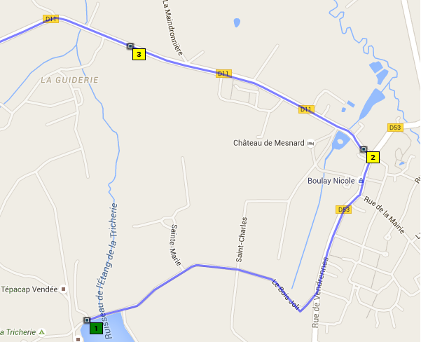
I often type routing problems :
Lac de La tricherie
https://www.openstreetmap.org/directions?engine=osrm_car&route=46.8541,-1.1147;46.8649,-1.1128#map=15/46.8594/-1.1070
Photo :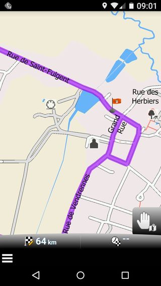
-
23 Comments sorted by
-
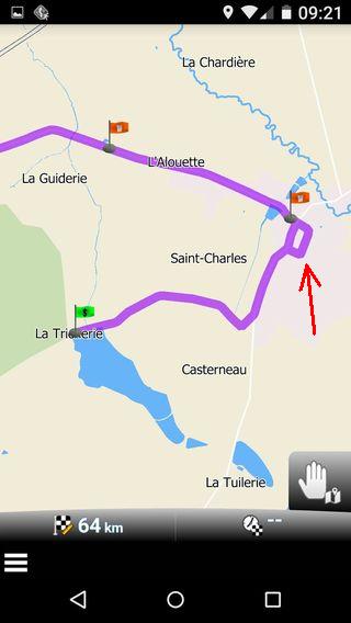
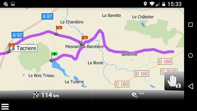
with default car settings I get route as per screenshot
https://drive.google.com/file/d/0BySR4mW9PHfWMFhueUt6LVlHMHM/view?usp=sharing
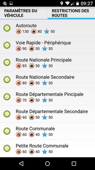
please check your settings
-
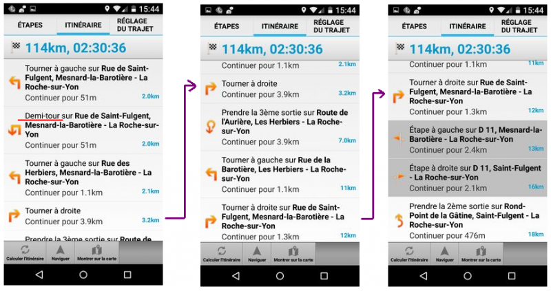
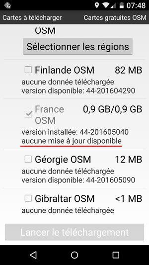
Is that mapversion 44-201605040 or 4050 at the end? One my phone I have 4050 (I understand this is April) and it offers an update to 5030 (May). I wonder if they have to different maps for May.
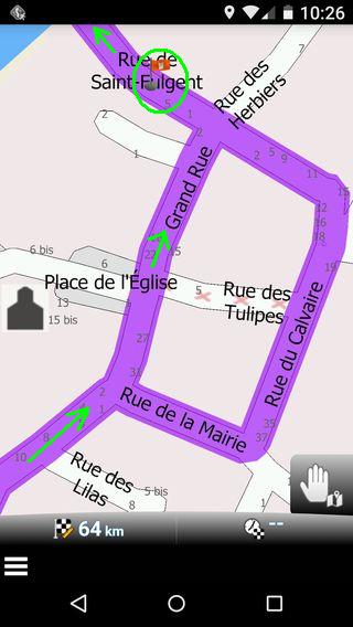
Anyway, where you have the demitour my itinéraire has the waypoint listed, i have set manually somewhere after the crossing. I wonder, why i makes a u-turn instead of a waypoint....
A wonder still is, why a new car (profile) makes a left turn afterwards (instead a relatively short round trough the village as with your older car).
-
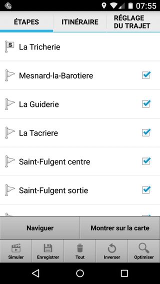
That route of yours: Did you create it yourself or did you import it from another program?If you created it yourself: how did you do that? Searching for places by address? Or putting waypoints along the road?If you imported a route: please share it with us. (I'm almost sure you imported it from another program). The names simply don't fit with Navigator which means that they come from something else.
-
ITN file :
-111687|4685361|La Tricherie|4|
-109990|4686077|Mesnard-la-Barotiere|0|
-111423|4686509|La Guiderie|0|
-114054|4685749|La Tacriere|0|
-117197|4685012|Saint-Fulgent centre|0|
-119862|4684988|Saint-Fulgent sortie|0|
-123182|4684019|Poi|0|
-126883|4683077|Chauche entree|0|
-127394|4682990|Chauche centre|0|
-128530|4683881|Chauche sortie|0|
-130418|4685593|Poi|0|
-132234|4687909|Les Brouzils entree|0|
-131838|4688740|Les Brouzils centre|0|
-132032|4689148|Les Brouzils sortie|0|
-131714|4691309|La Funerie|0|
-130990|4692999|Poi|0|
-129767|4694572|St-Georges-de-Montaigu|0|
-129306|4695133|La Migeonniere|0|
-125579|4696451|La Guyonniere entree|0|
-124594|4697070|La Guyonniere sortie|0|
-123483|4698223|Treize-Septiers entree|0|
-122853|4698549|Treize-Septiers centre|0|
-122013|4699202|Treize-Septiers sortie|0|
-120108|4701093|La Bruffiere entree|0|
-119802|4701489|La Bruffiere centre|0|
-120081|4702023|La Bruffiere sortie|0|
-119114|4702746|Poi|0|
-118450|4703651|Boussay entree|0|
-118587|4704470|Boussay centre|0|
-118443|4705198|Boussay sortie|0|
-117467|4707592|Goulgate|0|
-114096|4708540|La Frapiniere|0|
-112523|4709709|Montfaucon-Montigne- STATION|2|


Howdy, Stranger!
It looks like you're new here. If you want to get involved, click one of these buttons!
Categories
- All Discussions3,266
- Feature Requests1,276
- Bugs559
- General378
- Navigator FREE1,031
- Vehicle Tracking5
- Navigator 1017