Thoroughly Irrational Routing
-
Samsung Galaxy Tab 2 10.1
OSM maps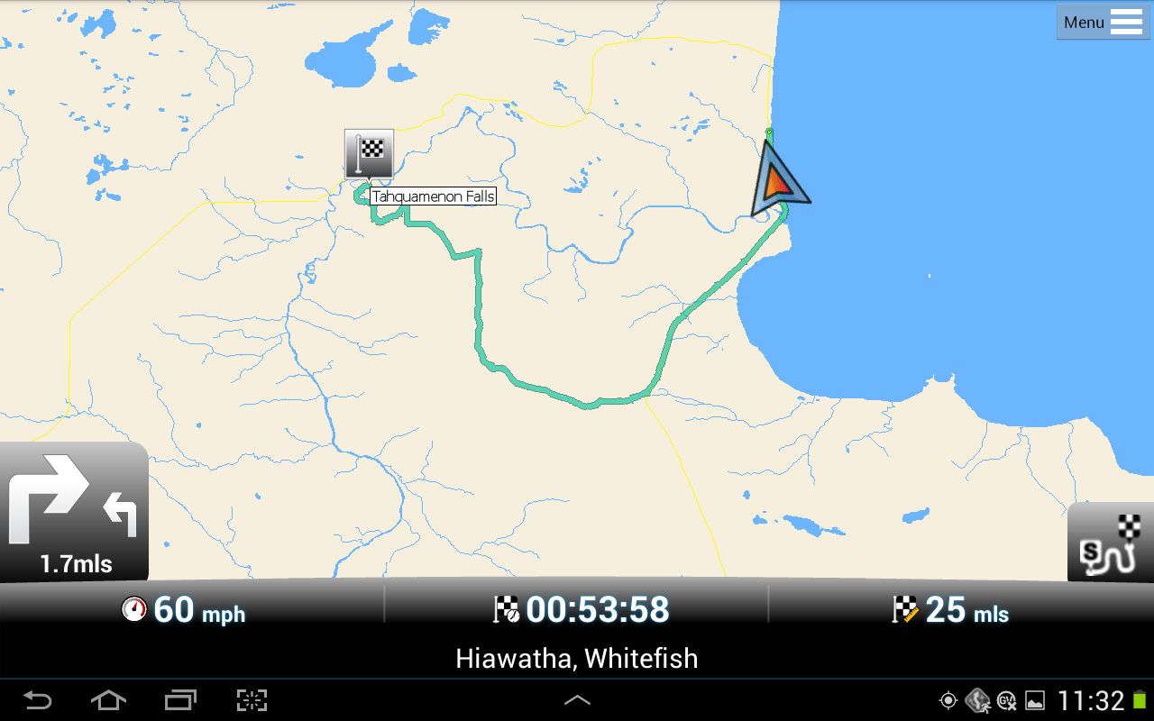
I believe we asked it to get us from Tahquamenon Falls, MI, to Munising. There are no highways where it was telling us to go. Not even rural routes. Just dirt/gravel back roads. At least according to the TomTom GPS and paper maps we had with us. (Thank God.)
Jim
-
1 Comment sorted by
-
Have to issue another correction/retraction, again: With my apologies. I knew there was something that was bothering me about that screenshot, vs. what I wrote I thought it was. That flag is a destinaton flag, not a start flag. And now I recall what was happening. There were a couple navigation anomalies during our Brimley -> Tahquamanon Falls trip segment: Both the MFN navigation (OSM maps were being used) and my wife's TomTom One (which she'd updated just a day or so before we left on our trip) seemed totally lost on that route. Or they came up with routes that made no sense at all. So we shut them off.
I think that, at the point of the screenshot above, what had happened was my wife figured "Okay, we're close enough now to the Google-recommended route (and also recommended by the local population) that the GPS' are bound to get it right, now, so let's see what they come up with.
The map I posted is what MFN with the OSM maps came up with. (I don't recall what her TomTom One came up with.)
Here is a Google Maps view of the area in question, for reference: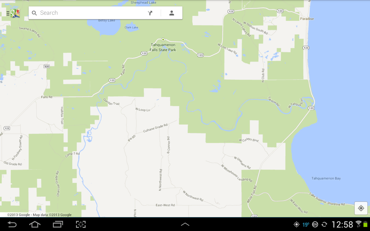
We were on the right side of the above, on 123, just above where the Tahquamenon River spills into Lake Superior.
The more efficient route was to continue north on 123, through Paradise, then on 123 west, which is what we did.
Again: Apologies for the misleading post.
Jim
Howdy, Stranger!
It looks like you're new here. If you want to get involved, click one of these buttons!
Categories
- All Discussions3,261
- Feature Requests1,273
- Bugs557
- General378
- Navigator FREE1,031
- Vehicle Tracking5
- Navigator 1017
In this Discussion
- jseymour August 2013