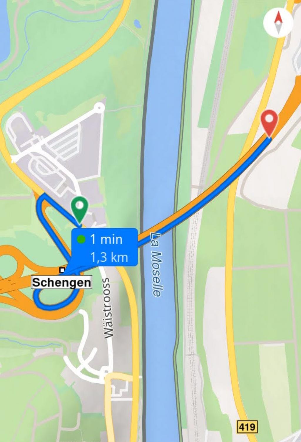
Route creation problem
-
Hello,I do not understand why navigator does not find a car route from this segment (Chemin : Liaison avec la Sarre (560815240) | OpenStreetMap) to this segment (Chemin : Liaison avec la Sarre (445536696) | OpenStreetMap)In Openstreetmap, I just modified the pedestrian crossing which was not in tunnel mode, could the fact that the pedestrian crossing was not in tunnel mode create a conflict with the highway?
-
11 Comments sorted by
-
Hi,there's something very strange in MFN data. When I start on N10 nearly underneath the highway A8 and want to drive to A8 where the bridge ist above N10 (direction east), i get an 1200 meters track on OpenStreetMap site:MFN will not go across the river, and when I set the target a bit more to the west of the river, I get a 420 Kilometers track goin to Liege and coming back ...Junction lanes are not connected to N10, and some parts of the highway are not connected to each other. I guess it wasn't you creating this fault - on OpenStreetMap site everything seems to be ok.Regards ...
-
It seems to me that the problem comes from the pedestrian path that crosses the highway, I modified the pedestrian path yesterday to put it in tunnel mode, we will have to see what happens after updating the map
-
I think problem is the Luxembourg/Germany borderlink 445536696 seems to be in Germany, but belongs to A13 (Luxembourg)border line is at 49.47894, 6.36711but links 445536701 and 445536696 (belonging to Luxembourg) are in GermanyI do not know what is incorrect, either border line or those two linkscan someone fix it?
-
I have the same problem the other way around.How to fix it?
-
Years ago we already had a problem with the Luxemburg/Germany condominium border.
-
A few meters away from the border and the pedestrians path, I can not create this route in MFN:Regards ...
-
I have no problem calculating this route with default car settings
-
Sorry, had wrong vehicle profile ...Tried again, no routing across the river. West bank is shown in blue, east bank is that small pink line (why pink?) compared to openstreetmap.org. Beetween those lines is shown as normal ground - should be water (blue) there. And there's a "crack" in the highway - when I want to create a route on the highway from one bank to the other - no way. Both directions.Crossing the pedestrians tunnel on the west by highway is no problem.Tested with PC Nav - not on android.Regards ...
-
Please note the pedestrian tunnel dates from Wednesday, so the pedestrian crossing is still in normal mode on MFN
-
Hello,After updating the German and Luxembourg maps, the problem is still present, does anyone have a solution?
-
Hi,I tried with an application that also uses Osm and it works fineStart : 49.4794, 6.3650End : 49.4817, 6.3721

Howdy, Stranger!
It looks like you're new here. If you want to get involved, click one of these buttons!
Categories
- All Discussions3,263
- Feature Requests1,274
- Bugs558
- General378
- Navigator FREE1,031
- Vehicle Tracking5
- Navigator 1017
In this Discussion
- florian February 2022
- MacDony February 2022
- Oldie January 2022
- RogerGatsky January 2022
- tomas January 2022
Tagged
- bug 56
- navigator_free 36
- problem 18
- pedestrian 6
- highways 2