Bugs river/ocean [solved]
-
Hi,
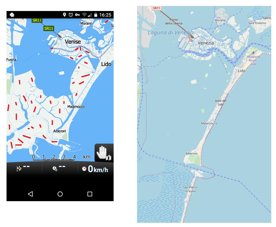
https://www.openstreetmap.org/edit#map=16/47.3991/-0.2966
on the right, the river view "La Loire" is ok
on the left the display is not done
Thx.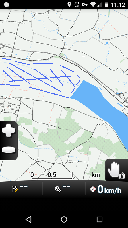
-
25 Comments sorted by
-
Maybe it's an osm bug ?!
You would have an idea about the problem ?! -
From time to time there a rendering issues especially for rivers and lakes. If I remember well, mostly resulting from errors from OSM data, but sometimes MF does not fully understand OSM data even if they are correct. No idea, what causes the problem here. Anyway at least for car use it seems to be rather evident, that there is a river. If you are traveling on a boat, that might be different. But I would not use MF for "navigating" on water.
-
I do not know what the reason is in this case, but often it is due to duplication of the same feature due to being in two administrative areas
-
Anyway rendering is as exspected, when I use Openandromaps with Oruxmaps. They do it better than MF ;)
-
But there are no streets as well. So don't worry, you will not be navigated into water. It is just a question, how it looks like.Just a couple of days I had an e-mail conversation with the creator of Openandromaps about the river Mosel, having no water also at some parts between Luxemburg and Germany. Since there is water in Mapnik online-maps he argued, that the online map format is more tolerant to faulty data in relations than his maps, which are created following the Mapsforge format. I have no clue about these technical things, I can just report, what he wrote to me.
-
Your other GPS app. What is it? And how old are the maps?Is it NavFree or Navmii? If so: check the date of the maps, probably 2016. They can be more than a year old. If a new OSM bug arises MNF will "detect" :) it quite soon because the maps are often updated.Do not simply compare maps from nav apps with each other without compairing map dates.
-
"check the date of the maps"That is, why in the case of the river Mosel (see above) I downloaded the latest Openandromaps before "complaing".I have checked now the Mapfactor map Germany as well and there the river Mosel does also have no water in it (near the city of Apach). It seems, that it is the same fault as with Openandromaps. That is an indication for me, that OSM data is not correct there.
-
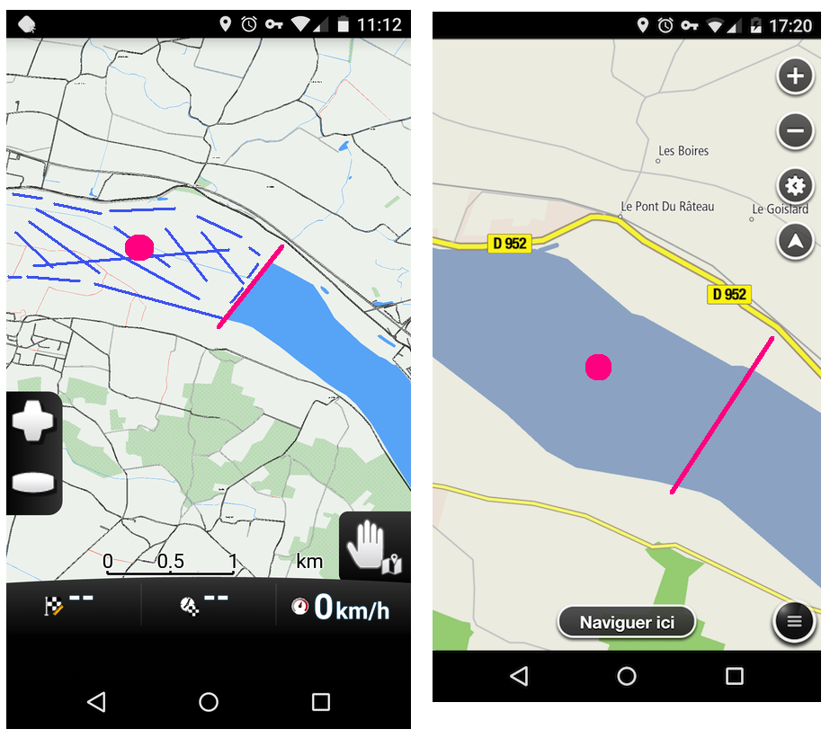
All these rivers and big lakes (Lac Neufchatel/lac de Geneva, Bodensee, etc) and rivers Loire, Rhine, Mosel, etc. are all built up of "(multi)polygons". These get easily "broken".A second error is if the multipolygon is split over two (or more) "administrative boundaries".Multiple map programs go wrong here. Openstreetmap is just one big database and you can just pan and zoom from Northern to Southern Germany or France.Nav apps often have to split up maps due to the 2GB limit on sdcards. If the map making software is "breaking" a multipolygon, you see nothing or just a single line (in case of a river).
-
" If the map making software is "breaking" a multipolygon, you see nothing or just a single line (in case of a river)" (By the way, I miss a quote function in this forum)Exactly such a single line you find in the Germany map of Openandromaps just a few km up the river Mosel from Apach, where the river "leaves" the map.But near Apach this must be such a split polygon. I tried to fix this with the Vespucci Android app. But since I am not very familiar with this app, I did not find, how to do it.Now I do not find any errors here. https://www.openstreetmap.org/way/368502304 The last edit was one month ago. Maybe the coming Mapfactor map will be ok already.
-
-
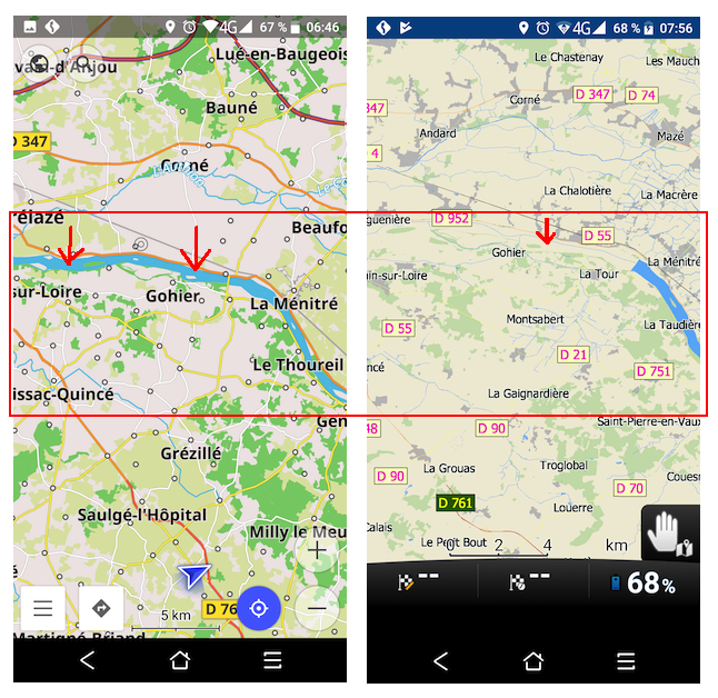
Like I said: it doesn't have to be a mistake in OSM.But your selection shows part of the Loire (the polygons), but also all the relations belonging to it. From this selection you can't see what is wrong.I think something is wrong with the bridge (D55) crossing the Loire and a broken relation with the Loire.But it is quite complicated and I'm currently on holiday with a weak data connection via my phone. I'm not going to analyze it.It seems that user https://www.openstreetmap.org/user/Eric-Chambly modified it. Please contact him via OSM.
-
This area is fine with OSM Mapnik online maps or openandromaps offline maps using Oruxmaps. Openstreetmap.org is also fine.Not so with Navigator (latest Playstore version and latest maps). So the problem seems to be on Mapfactor's side.
-
Hi all,The river "La Loire" is clearly visible on another Osm application with an update dated 1st November 2019
-
Any progress on this bug?
More examples: New Zealand Lake Manapouri, Lake Wakatipu (Queenstown), Vietnam Hoi River
I always compare with openstreetmap.org to see the map data.
As soon as there is progress, I would join analysing and testing. Polygons might be difficult to understand completely for the coding.
I look forward to read something soon!
Harald -
Hi Harald,
Now it's worse than before, the Loire has retreated 60 km and withdrew to Tours.
-
The maps of Openandromaps.org used with Oruxmaps show the water of the Loire river. It uses OSM data as well. That means, that it is mainly a poblem of Mapfactor Navigator.
-
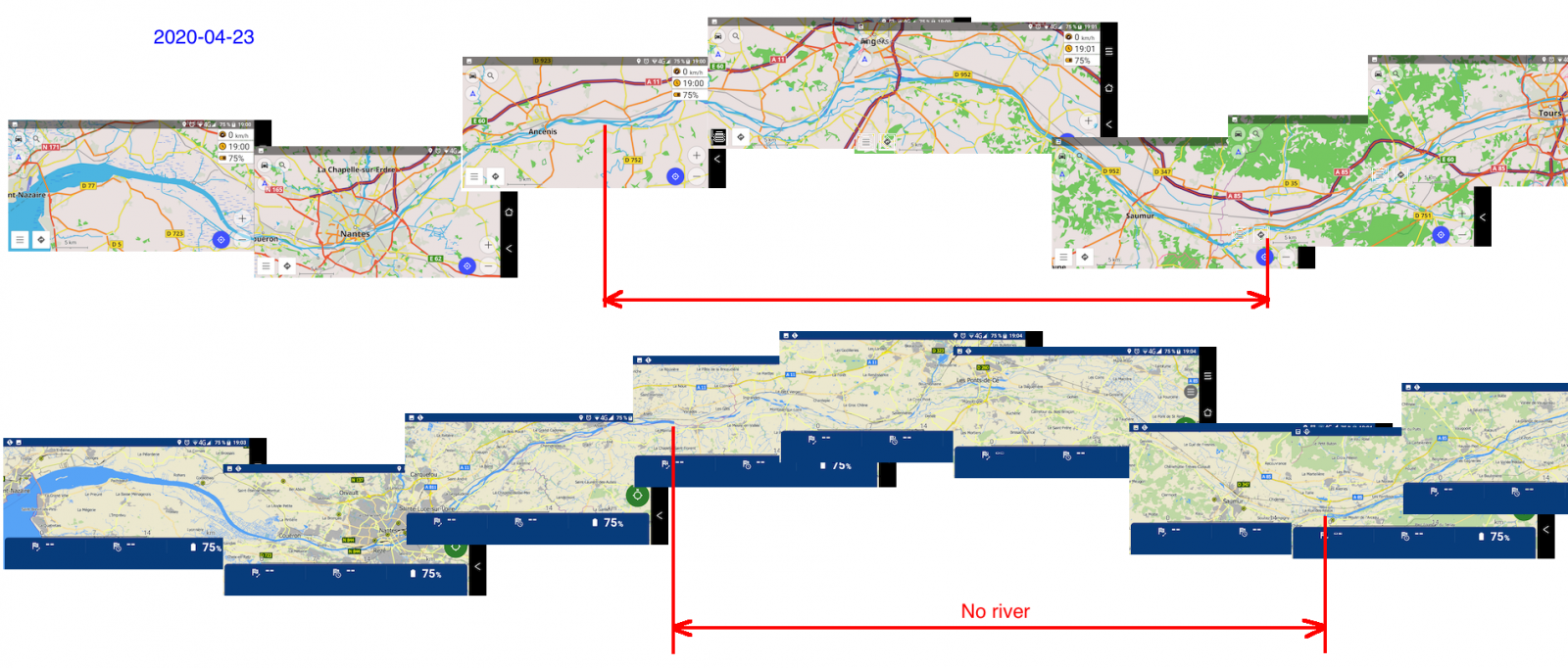
Hi,OSMand vs Navigator - 2020-04-23 - Loire River - France
-
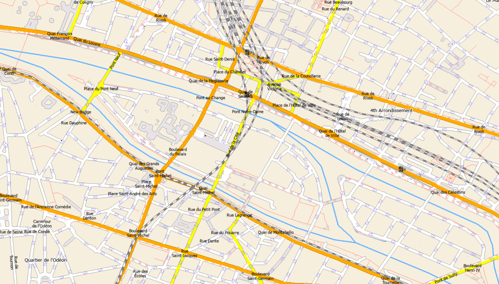
In the PC version, almost all French rivers are only shown as thin blue lines.e.g. La Seine à Paris:
-
Hi Tomas,great, the latest version of the maps has corrected the problem for the Loire, thank you:)
-
Small faults are still there - near Blois a section approx. 2 kilometers of La Loire is still a very small line.Didn't check all the rivers ...Same fron La Charite sur Loire up to Nevers - le "Canal lateral a la Loire" is shown correctly (seems much wider than the river).Regards ...

Howdy, Stranger!
It looks like you're new here. If you want to get involved, click one of these buttons!
Categories
- All Discussions3,228
- Feature Requests1,254
- Bugs553
- General374
- Navigator FREE1,025
- Vehicle Tracking5
- Navigator 1017