Inane Routing
-
Samsung Galaxy Tab 2 10.1
OSM maps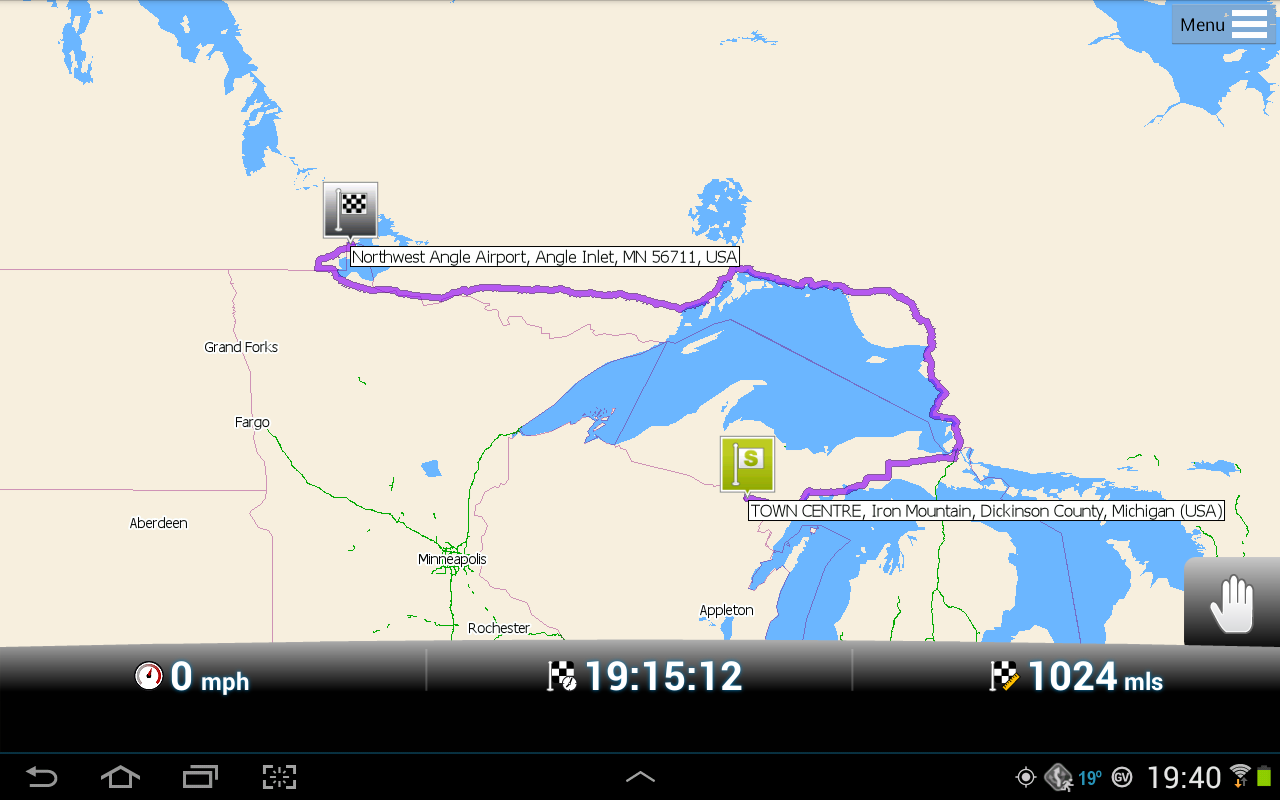
As an experiment: I gave it a challenging route: From Iron Mountain, MI (on the western border with Minnisota) to West Angle, MN.
It's challenging because the Angle Inlet area is a piece of the U.S. that can only be reached by road by travelling through some seriously rural northern Minnesota roads and a bit of Canada... or by plane, water or, in the wintertime, over ice.
It proved too much for the OSM maps, which would've taken me the entire length of Michigan's Upper Peninsula east, then up through Canada?
Btw: Mapping it with Google Maps, from home (in the Metro-Detroit area) produced a route estimated at a little over 17 hours. It did not go over the top of Lake Superior. (See same experiment with TomTom maps.)
Jim
-
2 Comments sorted by
-
Please disregard, with my apologies. User error. I'd loaded the TT map for Wisconsin, but not the OSM one. So, naturally, there was a rather significant lack of roads. Once I loaded the missing map, a sane route appeared. (With detail.)
Jim
Howdy, Stranger!
It looks like you're new here. If you want to get involved, click one of these buttons!
Categories
- All Discussions3,228
- Feature Requests1,254
- Bugs553
- General374
- Navigator FREE1,025
- Vehicle Tracking5
- Navigator 1017
In this Discussion
- jseymour August 2013